
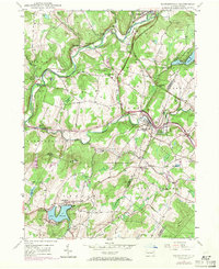
1946 Map of Factoryville
USGS Topo · Published 1968About this map
Factoryville serves as a primary hub in this Wyoming County landscape, where the Delaware Lackawanna and Western RR follows the winding course of the South Branch Tunkhannock Creek. The presence of Keystone College and the Factoryville Sta indicates a well-established community during the mid-1940s, balancing education and rail commerce. To the south, Lake Winola and its surrounding settlement represent a significant recreational and residential anchor, while the northern terrain is marked by smaller hamlets like Nicholson and Starkville.
Find a feature on this map
61 named features on this map. Tap any name to fly to it.
Don’t see what you’re looking for? This feature index may not catch every label — zoom into the map to look around manually.
Map Details
Editions of this 1946 Factoryville Map
2 editions found
Other maps of this area

1889 · Scranton
USGS Topo · 1:62,500

1891 · Scranton
USGS Topo · 1:62,500

1892 · Dundaff
USGS Topo · 1:62,500

1893 · Pittston
USGS Topo · 1:62,500

1893 · Scranton
USGS Topo · 1:62,500

1943 · Scranton
USGS Topo · 1:125,000

1946 · Tunkhannock
USGS Topo · 1:62,500

1946 · Dalton
USGS Topo · 1:24,000

1946 · Ransom
USGS Topo · 1:24,000
1946 · Center Moreland
USGS Topo · 1:24,000