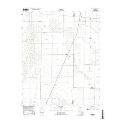
2017 Map of Fair Oaks
USGS Topo · Published 2017About this map
Fair Oaks and Penrose serve as the primary hubs in this agricultural landscape at the intersection of Woodruff, Cross, and St. Francis counties. The region is defined by a dense network of drainage canals and natural waterways like Second Creek and Caney Cr, which dictate the placement of local transport routes. The survey reveals a rural infrastructure reliant on small aviation facilities, including the Mc Crory/Morton Airport and Penrose Airport, which are likely utilized for agricultural operations and crop dusting. Small clusters such as Bemis and Barson are linked by a grid of county roads, while the western portion of the map is dominated by wetlands and named bodies of water like Brushy Lake, Sullivan Lake, and the adjacent Little Jack Lake and Big Jack Lake. This detailed view of the Arkansas delta highlights how the land has been subdivided into precise rectangular plots for intensive farming.
Find a feature on this map
47 named features on this map. Tap any name to fly to it.
Don’t see what you’re looking for? This feature index may not catch every label — zoom into the map to look around manually.
Map Details
Editions of this 2017 Fair Oaks Map
This is the sole edition of this map. No revisions or reprints were ever made.
Other maps of this area

1939 · Vanndale
USGS Topo · 1:62,500

1939 · Wynne
USGS Topo · 1:62,500

1939 · Hunter
USGS Topo · 1:62,500

1940 · Tilton
USGS Topo · 1:62,500

1953 · Memphis
USGS Topo · 1:250,000

1956 · Memphis
USGS Topo · 1:250,000

1956 · Tilton
USGS Topo · 1:62,500

1956 · Hunter
USGS Topo · 1:62,500

1958 · Hunter
USGS Topo · 1:62,500

1958 · Wynne
USGS Topo · 1:62,500