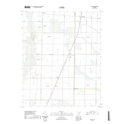
2020 Map of Fair Oaks
USGS Topo · Published 2020About this map
Fair Oaks and Penrose anchor this 2020 landscape where the flat, agricultural stretches of Woodruff and Cross Counties meet. The terrain is defined by a complex network of seasonal water bodies and drainage systems, most notably Bayou De View and the winding Second Creek. These watercourses are flanked by numerous named lakes, including Brushy Lake, Sullivan Lake, and the adjacent Little Jack Lake and Big Jack Lake, which suggest a low-lying, swampy character traditionally important for local hydrology and habitat.
Find a feature on this map
50 named features on this map. Tap any name to fly to it.
Don’t see what you’re looking for? This feature index may not catch every label — zoom into the map to look around manually.
Map Details
Editions of this 2020 Fair Oaks Map
This is the sole edition of this map. No revisions or reprints were ever made.
Other maps of this area

1939 · Vanndale
USGS Topo · 1:62,500

1939 · Wynne
USGS Topo · 1:62,500

1939 · Hunter
USGS Topo · 1:62,500

1940 · Tilton
USGS Topo · 1:62,500

1953 · Memphis
USGS Topo · 1:250,000

1956 · Memphis
USGS Topo · 1:250,000

1956 · Tilton
USGS Topo · 1:62,500

1956 · Hunter
USGS Topo · 1:62,500

1958 · Hunter
USGS Topo · 1:62,500

1958 · Wynne
USGS Topo · 1:62,500