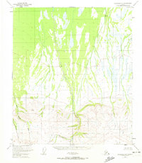
1949 Map of Fairbanks A-1
USGS Topo · Published 1972About this map
The interior Alaska wilderness north of the Alaska Range unfolds across this map based on 1949 aerial photography. The terrain is dominated by the north-flowing waters of Dry Creek and its complex network of tributaries, including Slide Creek and Threemile Creek. High points are marked by survey triangulation stations such as VABM 1277 Spirk in the north and the significantly higher VABM 3509 Slide in the southern highlands.
Find a feature on this map
7 named features on this map. Tap any name to fly to it.
Don’t see what you’re looking for? This feature index may not catch every label — zoom into the map to look around manually.
Map Details
Editions of this 1949 Fairbanks A-1 Map
2 editions found
Other maps of this area

1949 · Big Delta B-6
USGS Topo · 1:63,360

1949 · Big Delta A-6
USGS Topo · 1:63,360

1949 · Fairbanks A-2
USGS Topo · 1:63,360

1949 · Fairbanks A-1
USGS Topo · 1:63,360

1949 · Healy D-1
USGS Topo · 1:63,360

1950 · Fairbanks
USGS Topo · 1:250,000

1950 · Mount Hayes
USGS Topo · 1:250,000

1950 · Big Delta
USGS Topo · 1:250,000

1950 · Mount Hayes D-6
USGS Topo · 1:63,360

1950 · Fairbanks B-2
USGS Topo · 1:63,360