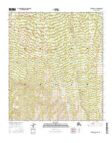
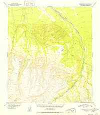
2016 Map of Fairbanks A-1 NW
USGS Topo · Published 2016About this map
Dry Creek winds through the interior landscape of the Alaska-Denali Borough, providing the primary hydrological landmark in this vast stretch of the subarctic. Surveyed by the U.S. Geological Survey to modern standards, the terrain is defined by complex contour elevations that illustrate the drainage patterns across several townships, including t8s r1e, t8s r2e, t9s r1e, and t9s r2e. This map documents the remote character of the Fairbanks A-1 NW region, where the Absence of permanent roads or settlements highlights the isolation of the Alaskan wilderness. Researchers studying the topography of the Denali area can use this record to trace the natural path of seasonal waterways and the precise boundaries of the Public Land Survey System as they existed in the early twenty-first century.
Find a feature on this map
5 named features on this map. Tap any name to fly to it.
Don’t see what you’re looking for? This feature index may not catch every label — zoom into the map to look around manually.
Map Details
Editions of this 2016 Fairbanks A-1 NW Map
This is the sole edition of this map. No revisions or reprints were ever made.
Other maps of this area

1949 · Fairbanks A-2
USGS Topo · 1:63,360

1949 · Fairbanks A-1
USGS Topo · 1:63,360

1950 · Fairbanks
USGS Topo · 1:250,000

1950 · Fairbanks B-2
USGS Topo · 1:63,360

1950 · Fairbanks B-1
USGS Topo · 1:63,360
1951 · Fairbanks B-1
USGS Topo · 1:63,360
1951 · Fairbanks B-2
USGS Topo · 1:63,360

1951 · Fairbanks
USGS Topo · 1:250,000
1952 · Fairbanks A-1
USGS Topo · 1:63,360
1952 · Fairbanks A-2
USGS Topo · 1:63,360