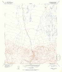
1952 Map of Fairbanks A-1
USGS Topo · Published 1952About this map
The interior Alaskan landscape is defined here by the winding course of Dry Creek and its tributary Slide Creek, captured during a 1949 aerial survey and published shortly thereafter. The topography reveals a dramatic transition from the alluvial flats and wetlands in the north toward the rising mountain fronts in the south. Surveyors from the Geological Survey utilized primary elevation markers such as VABM Slide 3609 and VABM Spirk 1277 to map this unpopulated wilderness. The map's contour lines and drainage patterns illustrate the complex hydrological network of the Fourth Judicial Division before significant modern development, providing a detailed record of the natural terrain as it existed in the mid-twentieth century.
Find a feature on this map
4 named features on this map. Tap any name to fly to it.
Don’t see what you’re looking for? This feature index may not catch every label — zoom into the map to look around manually.
Map Details
Editions of this 1952 Fairbanks A-1 Map
2 editions found
Other maps of this area

1949 · Big Delta B-6
USGS Topo · 1:63,360

1949 · Big Delta A-6
USGS Topo · 1:63,360

1949 · Fairbanks A-2
USGS Topo · 1:63,360

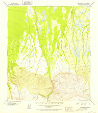
1949 · Fairbanks A-1
USGS Topo · 1:63,360

1949 · Healy D-1
USGS Topo · 1:63,360

1950 · Fairbanks
USGS Topo · 1:250,000

1950 · Mount Hayes
USGS Topo · 1:250,000

1950 · Big Delta
USGS Topo · 1:250,000

1950 · Mount Hayes D-6
USGS Topo · 1:63,360

1950 · Fairbanks B-2
USGS Topo · 1:63,360