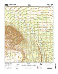
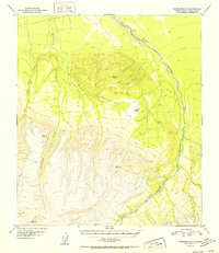
2016 Map of Fairbanks A-2 NE
USGS Topo · Published 2016About this map
The Wood River dominates this landscape within the Denali Borough, carving a broad alluvial valley that transitions from high-elevation relief in the southwest to expansive lowlands. The river's braided channels illustrate a dynamic hydrologic system, typical of the interior Alaskan wilderness before modern development altered these natural drainage patterns. In the more mountainous western sections, Chicken Cr descends through steep contours to join the main river valley, marking a significant drainage path for the surrounding high country.
Find a feature on this map
6 named features on this map. Tap any name to fly to it.
Don’t see what you’re looking for? This feature index may not catch every label — zoom into the map to look around manually.
Map Details
Editions of this 2016 Fairbanks A-2 NE Map
This is the sole edition of this map. No revisions or reprints were ever made.
Other maps of this area

1949 · Fairbanks A-2
USGS Topo · 1:63,360

1949 · Fairbanks A-1
USGS Topo · 1:63,360

1950 · Fairbanks
USGS Topo · 1:250,000

1950 · Fairbanks B-2
USGS Topo · 1:63,360

1950 · Fairbanks B-1
USGS Topo · 1:63,360
1951 · Fairbanks B-1
USGS Topo · 1:63,360
1951 · Fairbanks B-2
USGS Topo · 1:63,360

1951 · Fairbanks
USGS Topo · 1:250,000
1952 · Fairbanks A-1
USGS Topo · 1:63,360
1952 · Fairbanks A-2
USGS Topo · 1:63,360