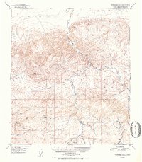
1952 Map of Fairbanks A-4
USGS Topo · Published 1952About this map
The Totatlanika River carves through this northern landscape, providing the primary drainage for a network of gold-bearing tributaries. In the early 1950s, resource extraction remained a central feature of the terrain, anchored by the Liberty Bell Mine and an active Placer Mine located along Coal Creek. The map documents a rugged industrial infrastructure where transport depended heavily on a Sled Road in the north and several isolated Airstrips near the mining camps. High elevation points like Rex Dome and VABM Coal 4165 overlook a complex watershed including California Creek and McAdam Creek. The distribution of scattered Cabins underscores the seasonal and transient nature of settlement during this period, focused almost entirely on the mineral potential of the drainage basins.
Find a feature on this map
32 named features on this map. Tap any name to fly to it.
Don’t see what you’re looking for? This feature index may not catch every label — zoom into the map to look around manually.
Map Details
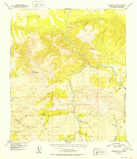
Editions of this 1952 Fairbanks A-4 Map
2 editions found
Other maps of this area

1949 · Fairbanks B-5
USGS Topo · 1:63,360

1949 · Fairbanks B-4
USGS Topo · 1:63,360

1949 · Fairbanks B-3
USGS Topo · 1:63,360

1950 · Fairbanks
USGS Topo · 1:250,000

1950 · Fairbanks A-5
USGS Topo · 1:63,360

1950 · Healy D-4
USGS Topo · 1:63,360

1950 · Fairbanks A-4
USGS Topo · 1:63,360

1950 · Fairbanks A-3
USGS Topo · 1:63,360

1950 · Healy D-3
USGS Topo · 1:63,360

1950 · Fairbanks B-5
USGS Topo · 1:63,360