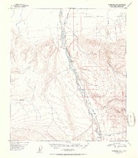
1951 Map of Fairbanks A-5
USGS Topo · Published 1951About this map
Nenana River dominates the central valley of this 1951 study, serving as the primary corridor for both natural and industrial movement. Running parallel to the water, The Alaska Railroad connects small rail-side settlements and markers such as Rex, Browne, and Mile 385. The proximity of these outposts to the river suggests a landscape defined by logistics and seasonal transport, where distance is measured by mileposts rather than urban density. To the east, a network of tributaries including Windy Creek, Chicken Creek, and Moose Creek carves into the high ground, while a designated Sled Road in the north indicates the reliance on winter transport routes during the mid-century era. The presence of isolated Cabins and surveying benchmarks like VABM Ferry 1522 highlights the remote nature of this Alaskan interior before modern highway expansion.
Find a feature on this map
20 named features on this map. Tap any name to fly to it.
Don’t see what you’re looking for? This feature index may not catch every label — zoom into the map to look around manually.
Map Details
Editions of this 1951 Fairbanks A-5 Map
2 editions found

Other maps of this area

1949 · Fairbanks B-5
USGS Topo · 1:63,360

1949 · Fairbanks B-4
USGS Topo · 1:63,360

1950 · Fairbanks
USGS Topo · 1:250,000

1950 · Fairbanks A-5
USGS Topo · 1:63,360

1950 · Healy D-4
USGS Topo · 1:63,360

1950 · Fairbanks A-4
USGS Topo · 1:63,360

1950 · Fairbanks B-5
USGS Topo · 1:63,360

1951 · Healy
USGS Topo · 1:250,000

1951 · Fairbanks B-5
USGS Topo · 1:63,360

1951 · Fairbanks
USGS Topo · 1:250,000