
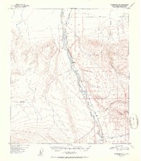
1951 Map of Fairbanks A-5
USGS Topo · Published 1951About this map
The Alaska Railroad follows the braided course of the Nenana River in this 1951 study of the Alaskan interior. The landscape is defined by the logistical challenges of the mid-century north, where the rail line serves as the primary artery for small outposts like Rex, Browne, and Ferry. These settlements are situated at strategic intervals along the riverbanks, often near significant water crossings or mile markers.
Find a feature on this map
16 named features on this map. Tap any name to fly to it.
Don’t see what you’re looking for? This feature index may not catch every label — zoom into the map to look around manually.
Map Details
Editions of this 1951 Fairbanks A-5 Map
2 editions found
Other maps of this area

1949 · Fairbanks B-5
USGS Topo · 1:63,360

1949 · Fairbanks B-4
USGS Topo · 1:63,360

1950 · Fairbanks
USGS Topo · 1:250,000

1950 · Fairbanks A-5
USGS Topo · 1:63,360

1950 · Healy D-4
USGS Topo · 1:63,360

1950 · Fairbanks A-4
USGS Topo · 1:63,360

1950 · Fairbanks B-5
USGS Topo · 1:63,360

1951 · Healy
USGS Topo · 1:250,000

1951 · Fairbanks B-5
USGS Topo · 1:63,360

1951 · Fairbanks
USGS Topo · 1:250,000