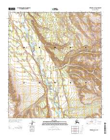
2013 Map of Fairbanks A-5 SE
USGS Topo · Published 2013About this map
The Nenana River carves through the central corridor of this interior Alaska landscape, providing a critical north-south passage through the high elevation terrain of the Denali Borough. The small settlement of Ferry sits along the river's eastern bank, marked by its namesake Ferry crossing, while the outpost of Moss is situated further north in the valley. This 2013 survey illustrates the modern transportation infrastructure of the region, anchored by the Parks Hwy which winds along the western slopes above the riverbed. Numerous drainage systems, including Moose Cr, Chicken Cr, and Walker Cr, feed into the main waterway from the surrounding ridges, defining a landscape shaped by glacial and alpine hydrology. This map is particularly useful for understanding the spatial relationship between the river-level settlements and the primary highway that connects Fairbanks and Anchorage.
Find a feature on this map
13 named features on this map. Tap any name to fly to it.
Don’t see what you’re looking for? This feature index may not catch every label — zoom into the map to look around manually.
Map Details
Editions of this 2013 Fairbanks A-5 SE Map
This is the sole edition of this map. No revisions or reprints were ever made.
Other maps of this area

1950 · Fairbanks
USGS Topo · 1:250,000

1950 · Fairbanks A-5
USGS Topo · 1:63,360

1950 · Healy D-4
USGS Topo · 1:63,360

1950 · Fairbanks A-4
USGS Topo · 1:63,360

1951 · Healy
USGS Topo · 1:250,000

1951 · Fairbanks
USGS Topo · 1:250,000

1951 · Fairbanks A-5
USGS Topo · 1:63,360

1951 · Healy D-5
USGS Topo · 1:63,360
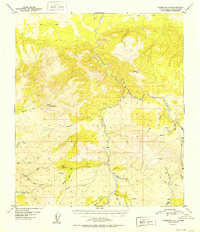
1952 · Fairbanks A-4
USGS Topo · 1:63,360

1952 · Healy D-5
USGS Topo · 1:63,360