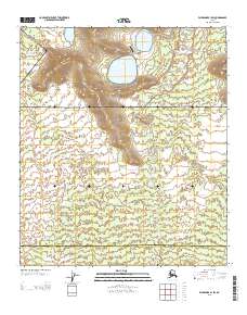
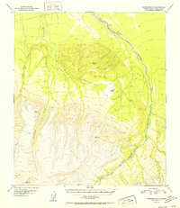
2013 Map of Fairbanks B-1 SW
USGS Topo · Published 2013About this map
Blair Lake Airport stands as a central operational point in this landscape within the Fairbanks North Star Denali boundary region. The area is defined by the significant hydrological presence of the Blair Lakes, which occupy a broad basin surrounded by shifting elevations. The drainage network is characterized by the meandering paths of Dry Creek and Clear Cr, suggesting a terrain that experiences seasonal flow and varying saturation. This 2013 survey illustrates the intersection of remote aviation infrastructure and the natural interior Alaskan water systems, capturing the spatial relationship between the landing facilities and the expansive wetlands of the Tanana Valley periphery.
Find a feature on this map
9 named features on this map. Tap any name to fly to it.
Don’t see what you’re looking for? This feature index may not catch every label — zoom into the map to look around manually.
Map Details
Editions of this 2013 Fairbanks B-1 SW Map
This is the sole edition of this map. No revisions or reprints were ever made.
Other maps of this area

1949 · Fairbanks A-2
USGS Topo · 1:63,360

1949 · Fairbanks A-1
USGS Topo · 1:63,360

1950 · Fairbanks
USGS Topo · 1:250,000

1950 · Fairbanks B-2
USGS Topo · 1:63,360

1950 · Fairbanks B-1
USGS Topo · 1:63,360
1951 · Fairbanks B-1
USGS Topo · 1:63,360
1951 · Fairbanks B-2
USGS Topo · 1:63,360

1951 · Fairbanks
USGS Topo · 1:250,000
1952 · Fairbanks A-1
USGS Topo · 1:63,360
1952 · Fairbanks A-2
USGS Topo · 1:63,360