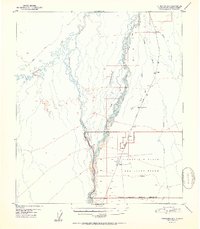
1951 Map of Fairbanks B-5
USGS Topo · Published 1951About this map
Clear Air Force Auxiliary Field dominates the central landscape of this interior Alaska survey, marked as inactive at the start of the 1950s. The region is defined by the braided path of the Nenana River and the winding Teklanika River, which create a complex network of waterways including Seventeenmile Slough and Lost Slough. Infrastructure in this wilderness era was largely tied to The Alaska Railroad, which parallels a string of milestones and small rail stops like Julius and Clear. Beyond the iron rail, transportation relied on seasonal routes such as a Sled Trail and Winter Trail, reflecting the extreme environment of the Fourth Judicial Division. Genealogists and historians can trace the early footprint of military and rail presence in this subarctic region before later twentieth-century developments altered the local geography.
Find a feature on this map
30 named features on this map. Tap any name to fly to it.
Don’t see what you’re looking for? This feature index may not catch every label — zoom into the map to look around manually.
Map Details
Editions of this 1951 Fairbanks B-5 Map
2 editions found
Other maps of this area

1949 · Fairbanks B-5
USGS Topo · 1:63,360

1949 · Fairbanks B-4
USGS Topo · 1:63,360

1950 · Fairbanks
USGS Topo · 1:250,000

1950 · Fairbanks C-5
USGS Topo · 1:63,360

1950 · Fairbanks A-5
USGS Topo · 1:63,360

1950 · Fairbanks C-4
USGS Topo · 1:63,360

1950 · Fairbanks A-4
USGS Topo · 1:63,360

1950 · Fairbanks B-5
USGS Topo · 1:63,360

1951 · Fairbanks B-5
USGS Topo · 1:63,360

1951 · Fairbanks
USGS Topo · 1:250,000