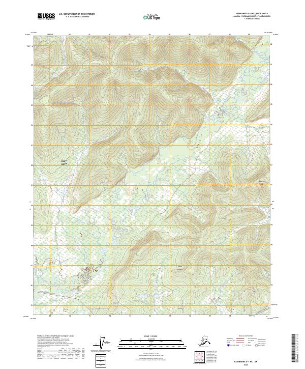
2024 Map of Fairbanks D-1 NE
USGS Topo · Published 2024About this map
The Little Chena River meanders through this landscape northeast of Fairbanks, carving a wide valley floor marked by wetlands and intricate drainage patterns from tributaries like Last Chance Creek and Caribou Creek. The settlement of Two Rivers sits as a central hub for the area's residents, while the community of Steele Creek occupies the higher elevations to the west. This topography transitions from the alluvial bottomlands of the river to the prominent ridges of the interior, illustrating the classic interior Alaskan geography where human development clings to the transit corridors and lower slopes.
Find a feature on this map
25 named features on this map. Tap any name to fly to it.
Don’t see what you’re looking for? This feature index may not catch every label — zoom into the map to look around manually.
Map Details
Editions of this 2024 Fairbanks D-1 NE Map
This is the sole edition of this map. No revisions or reprints were ever made.
Other maps of this area

1945 · Livengood
USGS Topo · 1:250,000

1949 · Fairbanks D-1
USGS Topo · 1:62,500

1950 · Fairbanks
USGS Topo · 1:250,000

1950 · Big Delta
USGS Topo · 1:250,000

1950 · Big Delta D-6
USGS Topo · 1:63,360

1951 · Big Delta
USGS Topo · 1:250,000

1951 · Fairbanks
USGS Topo · 1:250,000

1951 · Livengood
USGS Topo · 1:250,000

1951 · Circle
USGS Topo · 1:250,000

1952 · Big Delta D-6
USGS Topo · 1:63,360