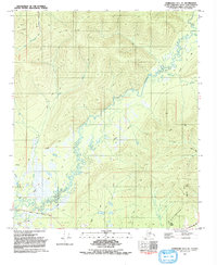
1992 Map of Fairbanks D-1 NE
USGS Topo · Published 1992About this map
Little Chena River meanders through the interior landscape of this 1990s survey, defining a drainage basin punctuated by active mining prospects and seasonal infrastructure. The southern portion of the map is anchored by the Two Rivers School and the Two Rivers Recreation Area, where Chena Hot Springs Road provides the primary corridor for regional travel. Away from the main road, the landscape is crisscrossed by a network of Winter Trails and Pack Trails, reflecting an area where movement is often dictated by the seasons and the rugged terrain.
Find a feature on this map
18 named features on this map. Tap any name to fly to it.
Don’t see what you’re looking for? This feature index may not catch every label — zoom into the map to look around manually.
Map Details
Editions of this 1992 Fairbanks D-1 NE Map
This is the sole edition of this map. No revisions or reprints were ever made.
Other maps of this area

1945 · Livengood
USGS Topo · 1:250,000

1949 · Fairbanks D-1
USGS Topo · 1:62,500

1950 · Fairbanks
USGS Topo · 1:250,000

1950 · Big Delta
USGS Topo · 1:250,000

1950 · Big Delta D-6
USGS Topo · 1:63,360

1951 · Big Delta
USGS Topo · 1:250,000

1951 · Fairbanks
USGS Topo · 1:250,000

1951 · Livengood
USGS Topo · 1:250,000

1951 · Circle
USGS Topo · 1:250,000

1952 · Big Delta D-6
USGS Topo · 1:63,360