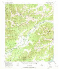
1950 Map of Fairbanks D-3
USGS Topo · Published 1971About this map
The Military Reservation at Murphy Dome overlooks a landscape defined by gold mining and remote interior transport in the mid-twentieth century. Near the central corridor of The Alaska Railroad, small communities like Saulich and Old Saulich signify the rail-driven connectivity of the era, while the eastern heights are marked by the Ester Dome Observatory and the settlement of Ester. This region is a complex web of drainage and industry, where Goldstream Creek and its many tributaries, such as Nugget Creek and Little Goldstream Creek, have long been the focus of mineral interests like the Fortune mine. To the south, the Bonanza Creek Experimental Forest borders the massive Tanana River, illustrating the intersection of resource management and natural hydrology in the Fairbanks North Star region.
Find a feature on this map
61 named features on this map. Tap any name to fly to it.
Don’t see what you’re looking for? This feature index may not catch every label — zoom into the map to look around manually.
Map Details
Editions of this 1950 Fairbanks D-3 Map
4 editions found
Other maps of this area

1945 · Livengood
USGS Topo · 1:250,000

1949 · Fairbanks D-2
USGS Topo · 1:62,500

1949 · Fairbanks D-3
USGS Topo · 1:63,360

1949 · Fairbanks D-4
USGS Topo · 1:63,360

1949 · Fairbanks C-2
USGS Topo · 1:63,360

1950 · Fairbanks
USGS Topo · 1:250,000

1950 · Fairbanks C-3
USGS Topo · 1:63,360

1950 · Fairbanks C-4
USGS Topo · 1:63,360

1950 · Fairbanks D-3
USGS Topo · 1:63,360

1951 · Fairbanks
USGS Topo · 1:250,000