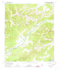
1950 Map of Fairbanks D-3
USGS Topo · Published 1974About this map
Murphy Dome and its associated military reservation overlook a landscape of deep ridges and creek valleys northwest of Fairbanks. This 1950 survey, updated with 1972 revisions, tracks the infrastructure of the Alaskan interior, from the winding route of the Alaska Railroad to the specialized facilities on Ester Dome, including a Ski Lodge and the Ester Dome Observatory. The map provides a detailed view of early settlements like Ester and the rail-stops at Saulich and Old Saulich, illustrating the transition from mining-era outposts to mid-century scientific and military development.
Find a feature on this map
45 named features on this map. Tap any name to fly to it.
Don’t see what you’re looking for? This feature index may not catch every label — zoom into the map to look around manually.
Map Details
Editions of this 1950 Fairbanks D-3 Map
4 editions found
Other maps of this area

1945 · Livengood
USGS Topo · 1:250,000

1949 · Fairbanks D-2
USGS Topo · 1:62,500

1949 · Fairbanks D-3
USGS Topo · 1:63,360

1949 · Fairbanks D-4
USGS Topo · 1:63,360

1949 · Fairbanks C-2
USGS Topo · 1:63,360

1950 · Fairbanks
USGS Topo · 1:250,000

1950 · Fairbanks C-3
USGS Topo · 1:63,360

1950 · Fairbanks C-4
USGS Topo · 1:63,360

1950 · Fairbanks D-3
USGS Topo · 1:63,360

1951 · Fairbanks
USGS Topo · 1:250,000