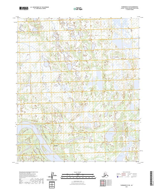
2024 Map of Fairbanks D-5 NE
USGS Topo · Published 2024About this map
Old Minto stands as a primary historical anchor on the banks of the Tanana River in this interior Alaskan landscape. The terrain is defined by a dense network of wetlands and complex hydrography, where the river's path is shadowed by Sawmill Slough. To the east, a series of large water bodies including Clear Lake, Grassy Lake, and Big Lake dominate the low-lying basin. Of particular note is Not-oolch'edodetthatt Bena, a traditional name reflecting the enduring indigenous presence and cultural geography of the Yukon-Koyukuk region. This map illustrates the intersection of ancient waterways and the established site of Old Minto, providing a clear view of the natural drainage patterns and the specific land divisions of T1N and T2N within ranges R7W and R8W.
Find a feature on this map
11 named features on this map. Tap any name to fly to it.
Don’t see what you’re looking for? This feature index may not catch every label — zoom into the map to look around manually.
Map Details
Editions of this 2024 Fairbanks D-5 NE Map
This is the sole edition of this map. No revisions or reprints were ever made.
Other maps of this area

1945 · Livengood
USGS Topo · 1:250,000

1949 · Fairbanks D-4
USGS Topo · 1:63,360

1950 · Fairbanks
USGS Topo · 1:250,000

1950 · Fairbanks D-5
USGS Topo · 1:63,360

1951 · Fairbanks
USGS Topo · 1:250,000

1951 · Livengood
USGS Topo · 1:250,000

1951 · Livengood A-5
USGS Topo · 1:63,360

1951 · Livengood A-4
USGS Topo · 1:63,360

1952 · Fairbanks D-4
USGS Topo · 1:63,360

1952 · Fairbanks
USGS Topo · 1:250,000