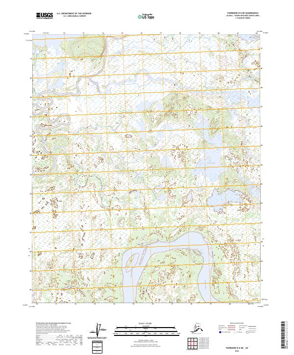
2024 Map of Fairbanks D-6 NE
USGS Topo · Published 2024About this map
The Tanana River dominates the southern landscape of this Yukon-Koyukuk region, its broad channel carving through a complex network of wetlands and oxbows. To the north, the Tolovana River meanders into the frame, illustrating the hydrologic character of this interior Alaskan basin where water courses define the geography. The presence of Swanneck Slough and the isolated Grassy Lake further underscores a terrain shaped by seasonal flooding and shifting riverbeds. This survey reflects a wilderness defined almost entirely by its riparian systems, with no established roads or settlements present within the quadrangle. The land is divided into the township and range grids of t2n r11w, t2n r10w, t1n r11w, and t1n r10w, which provide a formal structure over this vast, unpopulated alluvial plain.
Find a feature on this map
8 named features on this map. Tap any name to fly to it.
Don’t see what you’re looking for? This feature index may not catch every label — zoom into the map to look around manually.
Map Details
Editions of this 2024 Fairbanks D-6 NE Map
This is the sole edition of this map. No revisions or reprints were ever made.
Other maps of this area

1945 · Livengood
USGS Topo · 1:250,000

1950 · Fairbanks
USGS Topo · 1:250,000

1950 · Fairbanks D-5
USGS Topo · 1:63,360

1951 · Fairbanks
USGS Topo · 1:250,000

1951 · Livengood
USGS Topo · 1:250,000

1951 · Livengood A-5
USGS Topo · 1:63,360

1952 · Livengood A-6
USGS Topo · 1:63,360

1952 · Fairbanks
USGS Topo · 1:250,000
1952 · Fairbanks D-6
USGS Topo · 1:63,360

1953 · Livengood A-6
USGS Topo · 1:63,360