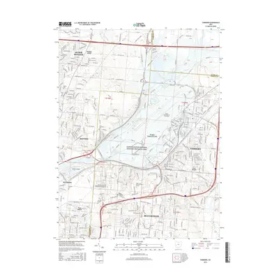
2016 Map of Fairborn
USGS Topo · Published 2016About this map
Dayton Aviation Heritage National Historical Park anchors this portion of the Miami Valley, illustrating the deep aeronautical legacy of the region. The landscape is dominated by the massive footprint of Wright-Patterson Air Force Base, which stretches across the central portion of the map, and the engineered control of the Mad River provided by Huffman Dam and the Huffman Reservoir. This intersection of military infrastructure and water management has fundamentally shaped the development of nearby Fairborn and Beavercreek.
Find a feature on this map
40 named features on this map. Tap any name to fly to it.
Don’t see what you’re looking for? This feature index may not catch every label — zoom into the map to look around manually.
Map Details
Editions of this 2016 Fairborn Map
This is the sole edition of this map. No revisions or reprints were ever made.
Other maps of this area

1904 · Springfield
USGS Topo · 1:62,500

1904 · Dayton
USGS Topo · 1:62,500

1906 · Dayton
USGS Topo · 1:62,500

1906 · Springfield
USGS Topo · 1:62,500

1913 · Waynesville
USGS Topo · 1:62,500

1915 · Waynesville
USGS Topo · 1:62,500

1917 · Xenia
USGS Topo · 1:62,500

1947 · Columbus
USGS Topo · 1:250,000

1953 · Cincinnati
USGS Topo · 1:250,000
1955 · Donnelsville
USGS Topo · 1:24,000