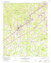
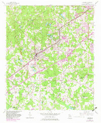
1954 Map of Fairburn
USGS Topo · Published 1974About this map
Fairburn and Union City sit at the center of this mid-century landscape, positioned along the vital transportation corridor of the Atlanta and West Point RR. The map captures a moment when rural agricultural patterns were still clearly defined by family-named landmarks and country institutions, even as the urban area began to extend. A network of community gathering places such as Union Grove Ch and Welcome Grove Ch dot the landscape, alongside the Word Sch.
Find a feature on this map
90 named features on this map. Tap any name to fly to it.
Don’t see what you’re looking for? This feature index may not catch every label — zoom into the map to look around manually.
Map Details
Editions of this 1954 Fairburn Map
6 editions found

Other maps of this area

1888 · Atlanta
USGS Topo · 1:125,000

1890 · Atlanta
USGS Topo · 1:125,000

1891 · Marietta
USGS Topo · 1:125,000

1892 · Atlanta
USGS Topo · 1:125,000

1895 · Atlanta
USGS Topo · 1:125,000

1895 · Marietta
USGS Topo · 1:125,000

1897 · Marietta
USGS Topo · 1:125,000

1901 · Marietta
USGS Topo · 1:125,000

1953 · Atlanta
USGS Topo · 1:250,000

1954 · Palmetto
USGS Topo · 1:24,000