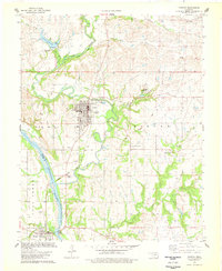
1978 Map of Fairfax
USGS Topo · Published 1978About this map
The town of Fairfax and the community of Gray Horse anchor this late-1970s survey of the Osage Indian Reservation Bdy. The Arkansas River carves the southwestern boundary, separating Osage and Pawnee counties and providing a natural backdrop for the area's industrial and agricultural landscape. The presence of the Fairfax Field and numerous scattered Oil Wells across the terrain speaks to the region's enduring ties to the petroleum industry, while the Atchison Topeka and Santa Fe Railroad tracks provide a vital transport link through Osage Junction.
Find a feature on this map
35 named features on this map. Tap any name to fly to it.
Don’t see what you’re looking for? This feature index may not catch every label — zoom into the map to look around manually.
Map Details
Editions of this 1978 Fairfax Map
This is the sole edition of this map. No revisions or reprints were ever made.
Other maps of this area

1929 · Skedee
USGS Topo · 1:62,500

1930 · Pawnee
USGS Topo · 1:62,500

1931 · Skedee
USGS Topo · 1:62,500

1932 · Fairfax
USGS Topo · 1:62,500

1936 · Belford
USGS Topo · 1:62,500

1936 · Pawnee
USGS Topo · 1:62,500

1955 · Enid
USGS Topo · 1:250,000

1958 · Enid
USGS Topo · 1:250,000

1964 · Charley Creek NE
USGS Topo · 1:24,000
1978 · Burbank
USGS Topo · 1:24,000