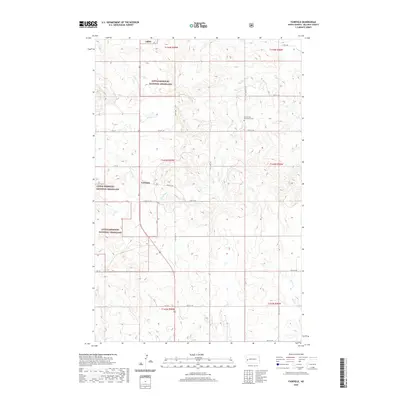
2020 Map of Fairfield
USGS Topo · Published 2020About this map
Fairfield serves as the central hub of this Billings County landscape, situated amid the expansive reaches of the Little Missouri National Grassland. The terrain is defined by the winding course of the Knife River, which cuts through the central sections of the quadrangle, and the smaller drainage of Horse Cr to the east. These waterways have historically dictated the placement of roads and settlements in this part of North Dakota. Local history is anchored by the Immaculate Conception Cem, located north of the town center. The map reflects a modern grid of rural roads and avenues, including 125th Ave and 14th St, that facilitate movement across the grassy plateaus and coulees. A notable section of the Prairie Trl provides a dedicated route through the national grassland, highlighting the area's preservation of its natural character.
Find a feature on this map
30 named features on this map. Tap any name to fly to it.
Don’t see what you’re looking for? This feature index may not catch every label — zoom into the map to look around manually.
Map Details
Editions of this 2020 Fairfield Map
This is the sole edition of this map. No revisions or reprints were ever made.
Other maps of this area

1953 · Watford City
USGS Topo · 1:250,000

1957 · Watford City
USGS Topo · 1:250,000

1963 · Fairfield SE
USGS Topo · 1:24,000

1963 · Fairfield
USGS Topo · 1:24,000

1963 · Gorham SE
USGS Topo · 1:24,000

1963 · Gorham
USGS Topo · 1:24,000

1963 · Rattlesnake Butte
USGS Topo · 1:24,000

1963 · Hungry Man Butte
USGS Topo · 1:24,000

1967 · Watford City
USGS Topo · 1:250,000

1974 · Grassy Butte SW
USGS Topo · 1:24,000