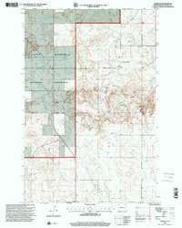
1997 Map of Fairfield
USGS Topo · Published 2001About this map
The Little Missouri National Grassland dominates this western North Dakota landscape, where the broken terrain is carved by the winding Knife River. Centered on the small community of Fairfield, the map reveals a rural economy shaped by ranching, energy extraction, and local education. Public land boundaries intersect with industrial infrastructure, notably a prominent Pipeline and a Compressor Station, illustrating the region's role in resource transport during the late 20th century.
Find a feature on this map
18 named features on this map. Tap any name to fly to it.
Don’t see what you’re looking for? This feature index may not catch every label — zoom into the map to look around manually.
Map Details
Editions of this 1997 Fairfield Map
This is the sole edition of this map. No revisions or reprints were ever made.
Other maps of this area

1953 · Watford City
USGS Topo · 1:250,000

1957 · Watford City
USGS Topo · 1:250,000

1963 · Fairfield SE
USGS Topo · 1:24,000

1963 · Fairfield
USGS Topo · 1:24,000

1963 · Gorham SE
USGS Topo · 1:24,000

1963 · Gorham
USGS Topo · 1:24,000

1963 · Rattlesnake Butte
USGS Topo · 1:24,000

1963 · Hungry Man Butte
USGS Topo · 1:24,000

1967 · Watford City
USGS Topo · 1:250,000

1974 · Grassy Butte SW
USGS Topo · 1:24,000