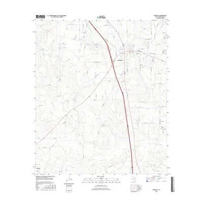
2016 Map of Fairfield
USGS Topo · Published 2016About this map
Fairfield serves as the central hub of this Freestone County landscape, where the intersection of major thoroughfares meets a network of rural routes like Old Kirven Rd and Old Palestine Rd. The town's grid extends east toward Tanbark Br and Mims Cr, showing a mix of established residential streets such as Ridgecrest St and Dejay St. Further south, the map reaches the outskirts of Teague, illustrating the corridor between these two primary settlements.
Find a feature on this map
105 named features on this map. Tap any name to fly to it.
Don’t see what you’re looking for? This feature index may not catch every label — zoom into the map to look around manually.
Map Details
Editions of this 2016 Fairfield Map
This is the sole edition of this map. No revisions or reprints were ever made.
Other maps of this area

1919 · Fairfield
USGS Topo · 1:62,500

1920 · Mexia
USGS Topo · 1:62,500

1954 · Waco
USGS Topo · 1:250,000

1955 · Waco
USGS Topo · 1:250,000

1961 · Young
USGS Topo · 1:24,000

1963 · Teague North
USGS Topo · 1:24,000

1963 · Kirvin
USGS Topo · 1:24,000
1963 · Stewards Mill
USGS Topo · 1:24,000

1965 · Dew
USGS Topo · 1:24,000
1965 · Lanely
USGS Topo · 1:24,000