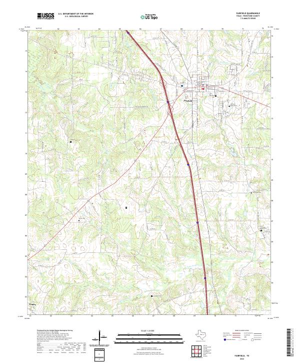
2022 Map of Fairfield
USGS Topo · Published 2022About this map
The Freestone County Courthouse serves as the focal point for the city of Fairfield, anchoring a landscape where small-town Texas infrastructure meets a network of rural creek drainage. This 2022 survey details the residential and commercial layout of the county seat, surrounded by a dense concentration of family and community burial grounds including Fairfield Cem, Fairfield Baptist Cem, and Poast Oak Cem. The terrain is defined by the headwaters of Upper Keechi Cr and Mims Cr, which weave through the agricultural land south of town.
Find a feature on this map
114 named features on this map. Tap any name to fly to it.
Don’t see what you’re looking for? This feature index may not catch every label — zoom into the map to look around manually.
Map Details
Editions of this 2022 Fairfield Map
This is the sole edition of this map. No revisions or reprints were ever made.
Other maps of this area

1919 · Fairfield
USGS Topo · 1:62,500

1920 · Mexia
USGS Topo · 1:62,500

1954 · Waco
USGS Topo · 1:250,000

1955 · Waco
USGS Topo · 1:250,000

1961 · Young
USGS Topo · 1:24,000

1963 · Teague North
USGS Topo · 1:24,000

1963 · Kirvin
USGS Topo · 1:24,000
1963 · Stewards Mill
USGS Topo · 1:24,000

1965 · Dew
USGS Topo · 1:24,000
1965 · Lanely
USGS Topo · 1:24,000