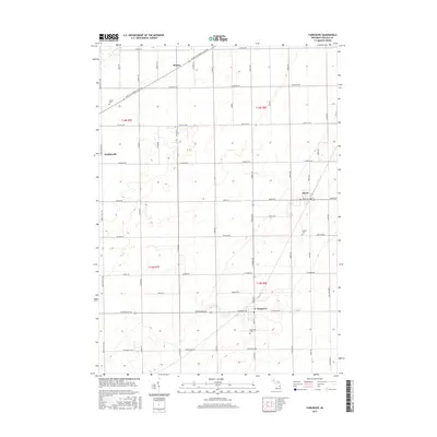
2017 Map of Fairgrove
USGS Topo · Published 2017About this map
Fairgrove and Akron anchor this agricultural region of Tuscola County, where the landscape is defined by a rigorous grid of section lines and township boundaries. The transition between t14n r8e and t13n r8e reveals a highly organized land-use pattern typical of Michigan's Thumb, dominated by long-established farmstead roads and drainage networks. Smaller historic hubs like Bradleyville and Wisner are connected by major thoroughfares such as W Bay City Forestville Rd and Cass City Rd. Genealogy researchers can find several notable burial sites serving these rural communities, including Brookside Cem near the southern edge, Perkins Cem to the east, and Wisner Cem in the northwest corner. This network of country roads, including Elmwood Rd and Dutcher Rd, provides a clear view of the settlement density and land divisions in the late 2010s.
Find a feature on this map
53 named features on this map. Tap any name to fly to it.
Don’t see what you’re looking for? This feature index may not catch every label — zoom into the map to look around manually.
Map Details
Editions of this 2017 Fairgrove Map
This is the sole edition of this map. No revisions or reprints were ever made.
Other maps of this area

1954 · Flint
USGS Topo · 1:250,000

1958 · Flint
USGS Topo · 1:250,000

1963 · Quanicassee
USGS Topo · 1:24,000

1963 · Fish Point
USGS Topo · 1:24,000

1963 · Fairgrove
USGS Topo · 1:24,000

1963 · Reese
USGS Topo · 1:24,000

1963 · Gilford
USGS Topo · 1:24,000

1963 · Caro
USGS Topo · 1:24,000

1963 · Colling
USGS Topo · 1:24,000

1963 · Sebewaing
USGS Topo · 1:24,000