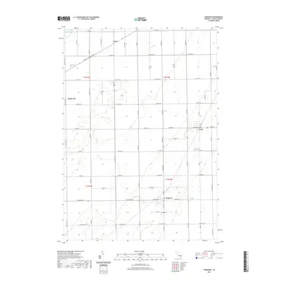
2019 Map of Fairgrove
USGS Topo · Published 2019About this map
Fairgrove and Akron anchor this agricultural portion of Tuscola County, where the geometric precision of the Public Land Survey System defines the landscape. The map captures a transition from the coastal influence of Lake Huron-Saginaw Bay in the northwest corner toward the deep interior farmlands. Smaller settlements like Wisner and Bradleyville are connected by an extensive grid of section-line roads, including the prominent W Bay City Forestville Rd. Local history is preserved in several dedicated spaces, such as Brookside Cem near Fairgrove and Perkins Cem south of Akron. The terrain is remarkably level, characterized by drainage patterns that support the region's intensive cultivation. This survey provides a clear view of the rural infrastructure, highlighting how major thoroughfares like Cass City Rd and Akron Rd facilitate movement between these tightly-knit village centers.
Find a feature on this map
55 named features on this map. Tap any name to fly to it.
Don’t see what you’re looking for? This feature index may not catch every label — zoom into the map to look around manually.
Map Details
Editions of this 2019 Fairgrove Map
This is the sole edition of this map. No revisions or reprints were ever made.
Other maps of this area

1954 · Flint
USGS Topo · 1:250,000

1958 · Flint
USGS Topo · 1:250,000

1963 · Quanicassee
USGS Topo · 1:24,000

1963 · Fish Point
USGS Topo · 1:24,000

1963 · Fairgrove
USGS Topo · 1:24,000

1963 · Reese
USGS Topo · 1:24,000

1963 · Gilford
USGS Topo · 1:24,000

1963 · Caro
USGS Topo · 1:24,000

1963 · Colling
USGS Topo · 1:24,000

1963 · Sebewaing
USGS Topo · 1:24,000