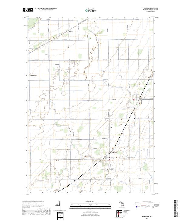
2023 Map of Fairgrove
USGS Topo · Published 2023About this map
Fairgrove and Akron anchor this survey of the Michigan Thumb, where a precise grid of rural section lines defines the agricultural landscape of Tuscola County. The map documents the persistent layout of small settlements and family farmsteads connected by a dense network of local roads such as W Bay City Forestville Rd and N Vassar Rd. These thoroughfares serve as the primary arteries for the region’s farming economy, linking outlying crossroads like Wisner and Bradleyville to larger centers.
Find a feature on this map
54 named features on this map. Tap any name to fly to it.
Don’t see what you’re looking for? This feature index may not catch every label — zoom into the map to look around manually.
Map Details
Editions of this 2023 Fairgrove Map
This is the sole edition of this map. No revisions or reprints were ever made.
Other maps of this area

1954 · Flint
USGS Topo · 1:250,000

1958 · Flint
USGS Topo · 1:250,000

1963 · Quanicassee
USGS Topo · 1:24,000

1963 · Fish Point
USGS Topo · 1:24,000

1963 · Fairgrove
USGS Topo · 1:24,000

1963 · Reese
USGS Topo · 1:24,000

1963 · Gilford
USGS Topo · 1:24,000

1963 · Caro
USGS Topo · 1:24,000

1963 · Colling
USGS Topo · 1:24,000

1963 · Sebewaing
USGS Topo · 1:24,000