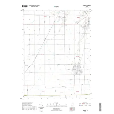
2019 Map of Fairmount
USGS Topo · Published 2019About this map
Marion and Gas City dominate the northeastern corner of this Grant County landscape, where the urban grid of Jonesboro transitions into a region defined by an extensive drainage network. The Strawtown Pike cuts a diagonal path across the territory, connecting smaller rural hubs like Radley and Weaver while paralleling the course of Deer Creek. This thoroughfare reflects the historic overland travel patterns of central Indiana, linking agricultural districts to the regional center at Marion.
Find a feature on this map
76 named features on this map. Tap any name to fly to it.
Don’t see what you’re looking for? This feature index may not catch every label — zoom into the map to look around manually.
Map Details
Editions of this 2019 Fairmount Map
This is the sole edition of this map. No revisions or reprints were ever made.
Other maps of this area

1953 · Muncie
USGS Topo · 1:250,000

1956 · Muncie
USGS Topo · 1:250,000

1960 · Elwood
USGS Topo · 1:24,000

1960 · Point Isabel
USGS Topo · 1:24,000

1960 · Alexandria
USGS Topo · 1:24,000

1960 · Fairmount
USGS Topo · 1:24,000

1960 · Gas City
USGS Topo · 1:24,000

1960 · Gaston
USGS Topo · 1:24,000

1961 · Marion
USGS Topo · 1:24,000
1962 · Sweetser
USGS Topo · 1:24,000