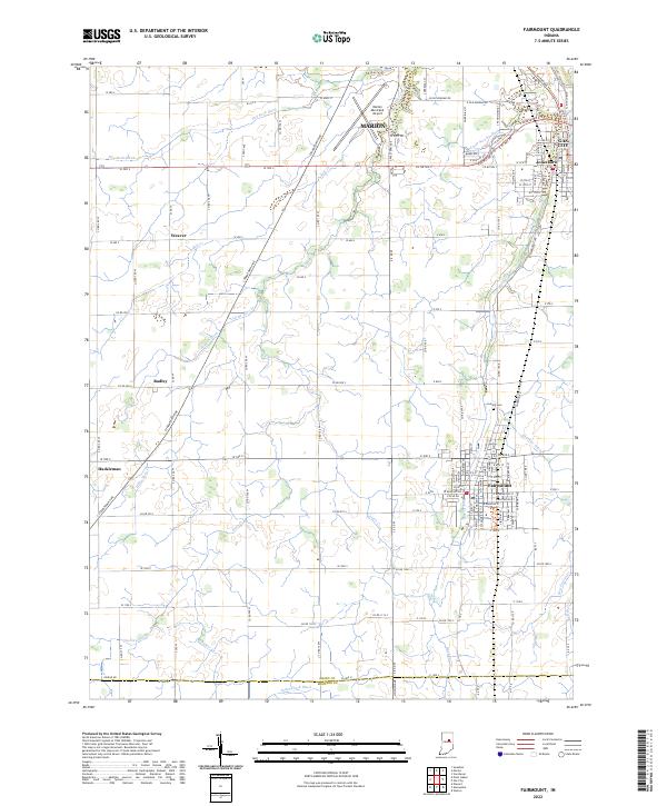
2022 Map of Fairmount
USGS Topo · Published 2022About this map
Fairmount serves as the central hub of this Indiana landscape, situated at the intersection of a sprawling rural road network and the flowing Back Cr. To the north, the urban footprints of Gas City and Jonesboro sit near the Little Newby Ditch, while the Marion Municipal Airport anchors the edge of Marion. The map reveals a transition from these concentrated town centers to a grid of agricultural lands punctuated by small communities like Weaver, Radley, and Hackleman.
Find a feature on this map
126 named features on this map. Tap any name to fly to it.
Don’t see what you’re looking for? This feature index may not catch every label — zoom into the map to look around manually.
Map Details
Editions of this 2022 Fairmount Map
This is the sole edition of this map. No revisions or reprints were ever made.
Other maps of this area

1953 · Muncie
USGS Topo · 1:250,000

1956 · Muncie
USGS Topo · 1:250,000

1960 · Elwood
USGS Topo · 1:24,000

1960 · Point Isabel
USGS Topo · 1:24,000

1960 · Alexandria
USGS Topo · 1:24,000

1960 · Fairmount
USGS Topo · 1:24,000

1960 · Gas City
USGS Topo · 1:24,000

1960 · Gaston
USGS Topo · 1:24,000

1961 · Marion
USGS Topo · 1:24,000
1962 · Sweetser
USGS Topo · 1:24,000