
1943 Map of Fairmount
USGS Topo · Published 1948About this map
The salt marshes and coastal inlets of Rehoboth Bay define this mid-century landscape in Sussex County, where the transition from inland agriculture to maritime life is clearly visible. The area is marked by numerous family-named landings and points, such as Robinson Ldg and Sloan Ldg, which dot the complex shoreline of Angola Neck and Long Neck. Transport by air and rail was firmly established by the 1940s, evidenced by the Rehoboth Airport CAP and the Willowmer Seaplane Base, while the (Delmarva Division) of the Pennsylvania Railroad served inland settlements like Cool Spring and Pinetown. Social and community hubs were well-distributed through small rural centers including Robinsonville, Hollymount, and Belltown. Local industrial and civic history is grounded in features like the Gosling Mill and the Cool Spring Grange, while the presence of the Drawbridge School and Eldorado Sch highlights the educational geography of the era.
Find a feature on this map
95 named features on this map. Tap any name to fly to it.
Don’t see what you’re looking for? This feature index may not catch every label — zoom into the map to look around manually.
Map Details
Editions of this 1943 Fairmount Map
This is the sole edition of this map. No revisions or reprints were ever made.
Other maps of this area

1917 · Millsboro
USGS Topo · 1:62,500

1918 · Cedar Creek
USGS Topo · 1:62,500

1918 · Rehoboth
USGS Topo · 1:62,500

1918 · Cape Henlopen
USGS Topo · 1:62,500

1919 · Cedar Creek
USGS Topo · 1:62,500

1937 · Cape Henlopen
USGS Topo · 1:62,500

1938 · Cedar Creek
USGS Topo · 1:62,500

1938 · Millsboro
USGS Topo · 1:62,500

1938 · Rehoboth
USGS Topo · 1:62,500
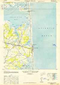
1943 · Bethany Beach
USGS Topo · 1:24,000
Featured Places
- Angola Crest Mobile Home Park, DE
- Angola Landing, DE
- Cool Spring, DE
- William Ritter Manor, DE
- Mallard Point, DE