
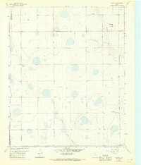
1960 Map of Fairview
USGS Topo · Published 1961About this map
The High Plains of the Texas Panhandle are defined here by a series of ephemeral lakes and sinkholes, characteristic of the Llano Estacado landscape. In the early 1960s, the small settlement of Fairview stood as a focal point for a network of named agricultural operations, including Valleyview Farm, Willow Valley Farm, and Clear Vue Farm. This pattern of naming individual farmsteads suggests a well-established ranching and farming community where land ownership and local identity were closely tied to specific tracts.
Find a feature on this map
15 named features on this map. Tap any name to fly to it.
Don’t see what you’re looking for? This feature index may not catch every label — zoom into the map to look around manually.
Map Details
Editions of this 1960 Fairview Map
Other maps of this area

1954 · Amarillo
USGS Topo · 1:250,000

1954 · Plainview
USGS Topo · 1:250,000

1956 · Fortress Cliff
USGS Topo · 1:24,000

1956 · Washburn
USGS Topo · 1:24,000

1956 · Thomas Ranch
USGS Topo · 1:24,000

1956 · Pullman
USGS Topo · 1:24,000

1958 · Amarillo
USGS Topo · 1:250,000

1958 · Plainview
USGS Topo · 1:250,000

1960 · Claude
USGS Topo · 1:62,500

1960 · Wayside
USGS Topo · 1:62,500