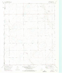
1960 Map of Fairview
USGS Topo · Published 1975About this map
The Randall Co Armstrong Co line divides this High Plains landscape, where agricultural life is defined by scattered farmsteads and a grid of rural roads. In the early 1960s, operations like Valleyview Farm, Willow Valley Farm, and Clear Vue Farm anchored the local economy, while the small settlement of Fairview served as a central point along Fairview Road. The terrain is marked by the dramatic descent into Skunk Hollow and the broader Canyon system carved by Mulberry Creek and Rush Creek, providing a stark contrast to the level fields where Tumbleweed Road and Antelope Road run.
Find a feature on this map
15 named features on this map. Tap any name to fly to it.
Don’t see what you’re looking for? This feature index may not catch every label — zoom into the map to look around manually.
Map Details
Editions of this 1960 Fairview Map
Other maps of this area

1954 · Amarillo
USGS Topo · 1:250,000

1954 · Plainview
USGS Topo · 1:250,000

1956 · Fortress Cliff
USGS Topo · 1:24,000

1956 · Washburn
USGS Topo · 1:24,000

1956 · Thomas Ranch
USGS Topo · 1:24,000

1956 · Pullman
USGS Topo · 1:24,000

1958 · Amarillo
USGS Topo · 1:250,000

1958 · Plainview
USGS Topo · 1:250,000

1960 · Fairview
USGS Topo · 1:24,000

1960 · Claude
USGS Topo · 1:62,500