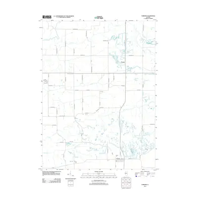
2012 Map of Fairview
USGS Topo · Published 2012About this map
Fairview and Rapatee anchor this section of the Illinois prairie, situated among the complex drainage networks of Coal Creek and its many tributaries. The landscape is deeply etched by water, with Little Coal Creek, S Fork Coal Creek, and N Br Coal Creek winding through the terrain toward the Spoon River in the northwest. This 2012 survey illustrates a region where the rural grid is punctuated by numerous family and community burial grounds, reflecting generations of settlement history.
Find a feature on this map
63 named features on this map. Tap any name to fly to it.
Don’t see what you’re looking for? This feature index may not catch every label — zoom into the map to look around manually.
Map Details
Editions of this 2012 Fairview Map
This is the sole edition of this map. No revisions or reprints were ever made.
Other maps of this area

1912 · Canton
USGS Topo · 1:62,500

1915 · Avon
USGS Topo · 1:62,500

1925 · Galesburg
USGS Topo · 1:62,500

1927 · Galesburg
USGS Topo · 1:62,500

1941 · Maquon
USGS Topo · 1:62,500

1943 · Maquon
USGS Topo · 1:62,500

1944 · Avon
USGS Topo · 1:62,500

1958 · Burlington
USGS Topo · 1:250,000

1961 · Burlington
USGS Topo · 1:250,000

1963 · Burlington
USGS Topo · 1:250,000