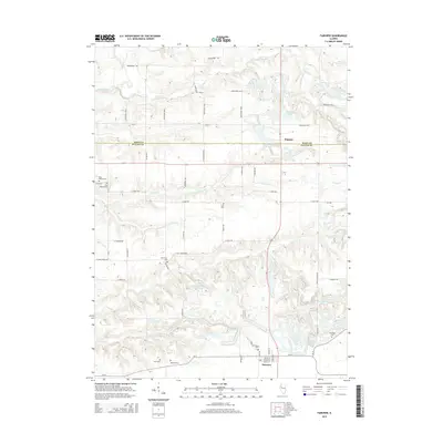
2015 Map of Fairview
USGS Topo · Published 2015About this map
Rapatee and the surrounding farm country on the Knox and Fulton county line are defined by a complex network of drainage creeks and established rural cemeteries. The landscape is carved by the Spoon River in the northwest and a series of tributaries including Littlers Cr, Swegle Cr, and Coal Cr. For family historians, this area is particularly dense with burial sites that mark the lineage of local townships, from Fairview Cem at the southern edge to the grouped West Midway Cem and East Midway Cem in the west. The presence of Keystone Anglers Club Lake and Old Five Lake suggests a tradition of local recreation amidst the agricultural grid. A network of township roads, such as Knox Road 100 N and E Coal Church RD, provides clear evidence of the historic land divisions and community centers that have sustained this part of Illinois for generations.
Find a feature on this map
54 named features on this map. Tap any name to fly to it.
Don’t see what you’re looking for? This feature index may not catch every label — zoom into the map to look around manually.
Map Details
Editions of this 2015 Fairview Map
This is the sole edition of this map. No revisions or reprints were ever made.
Other maps of this area

1912 · Canton
USGS Topo · 1:62,500

1915 · Avon
USGS Topo · 1:62,500

1925 · Galesburg
USGS Topo · 1:62,500

1927 · Galesburg
USGS Topo · 1:62,500

1941 · Maquon
USGS Topo · 1:62,500

1943 · Maquon
USGS Topo · 1:62,500

1944 · Avon
USGS Topo · 1:62,500

1958 · Burlington
USGS Topo · 1:250,000

1961 · Burlington
USGS Topo · 1:250,000

1963 · Burlington
USGS Topo · 1:250,000