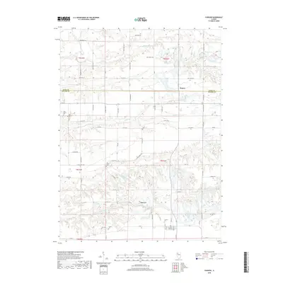
2018 Map of Fairview
USGS Topo · Published 2018About this map
Fairview and Rapatee anchor this landscape along the boundary of Knox and Fulton Counties, where a dense network of country roads connects scattered homesteads and burial grounds. The area is defined by the winding drainages of Coal Cr and Swegle Cr, which cut through the agricultural tablelands to feed the Spoon River. Genealogists will find particular value in the numerous small family and community cemeteries documented here, including Markley Cem, Beer Cem, and Shumaker Cem, often tucked away near stream branches or road junctions. Water features like Keystone Anglers Club Lake and various forks of the local creeks reveal a terrain shaped by drainage and small-scale recreation. The grid of rural routes, such as E Coal Church Rd and Schoonover Rd, illustrates the persistent township and range settlement pattern that has organized this Illinois farmland for generations.
Find a feature on this map
68 named features on this map. Tap any name to fly to it.
Don’t see what you’re looking for? This feature index may not catch every label — zoom into the map to look around manually.
Map Details
Editions of this 2018 Fairview Map
This is the sole edition of this map. No revisions or reprints were ever made.
Other maps of this area

1912 · Canton
USGS Topo · 1:62,500

1915 · Avon
USGS Topo · 1:62,500

1925 · Galesburg
USGS Topo · 1:62,500

1927 · Galesburg
USGS Topo · 1:62,500

1941 · Maquon
USGS Topo · 1:62,500

1943 · Maquon
USGS Topo · 1:62,500

1944 · Avon
USGS Topo · 1:62,500

1958 · Burlington
USGS Topo · 1:250,000

1961 · Burlington
USGS Topo · 1:250,000

1963 · Burlington
USGS Topo · 1:250,000