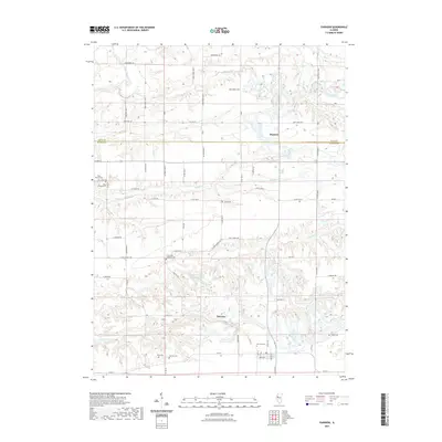
2021 Map of Fairview
USGS Topo · Published 2021About this map
Fairview serves as the primary hub of this landscape, situated at the junction of several county roads and home to the expansive Fairview Cem. The terrain is defined by the intricate drainage systems of Coal Creek and its many tributaries, such as the North Branch Coal Creek and South Fork Coal Creek, which carve deep valleys through the Illinois prairie. To the north, the small settlement of Rapatee sits near the Knox County and Fulton County line, surrounded by a high density of family and community burial grounds including the Beer Cem, Markley Cem, and the Coal Creek Lutheran Cem. This map shows a deeply rural environment where the local economy and social history are anchored by these established cemeteries and the Keystone Anglers Club Lake, highlighting a region where long-standing land divisions and small-scale water features dictate the movement of roads and settlements.
Find a feature on this map
60 named features on this map. Tap any name to fly to it.
Don’t see what you’re looking for? This feature index may not catch every label — zoom into the map to look around manually.
Map Details
Editions of this 2021 Fairview Map
This is the sole edition of this map. No revisions or reprints were ever made.
Other maps of this area

1912 · Canton
USGS Topo · 1:62,500

1915 · Avon
USGS Topo · 1:62,500

1925 · Galesburg
USGS Topo · 1:62,500

1927 · Galesburg
USGS Topo · 1:62,500

1941 · Maquon
USGS Topo · 1:62,500

1943 · Maquon
USGS Topo · 1:62,500

1944 · Avon
USGS Topo · 1:62,500

1958 · Burlington
USGS Topo · 1:250,000

1961 · Burlington
USGS Topo · 1:250,000

1963 · Burlington
USGS Topo · 1:250,000