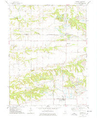
1974 Map of Fairview
USGS Topo · Published 1978About this map
The Chicago and North Western railroad corridor defines the northern landscape of this central Illinois territory, connecting the small settlements of Rapatee and Swegle across the Knox and Fulton County line. In the mid-1970s, the terrain south of the tracks reveals a heavy industrial influence, dominated by extensive strip mined areas that have reshaped the topography around the South Fork of Coal Creek.
Find a feature on this map
30 named features on this map. Tap any name to fly to it.
Don’t see what you’re looking for? This feature index may not catch every label — zoom into the map to look around manually.
Map Details
Editions of this 1974 Fairview Map
This is the sole edition of this map. No revisions or reprints were ever made.
Other maps of this area

1912 · Canton
USGS Topo · 1:62,500

1915 · Avon
USGS Topo · 1:62,500

1925 · Galesburg
USGS Topo · 1:62,500

1927 · Galesburg
USGS Topo · 1:62,500

1941 · Maquon
USGS Topo · 1:62,500

1943 · Maquon
USGS Topo · 1:62,500

1944 · Avon
USGS Topo · 1:62,500

1958 · Burlington
USGS Topo · 1:250,000

1961 · Burlington
USGS Topo · 1:250,000

1963 · Burlington
USGS Topo · 1:250,000