
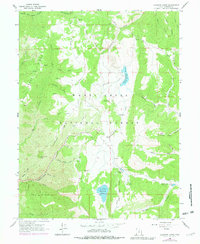
1965 Map of Fairview Lakes
USGS Topo · Published 1968About this map
Manti-La Sal National Forest dominates this high-altitude terrain in the mid-1960s, defined by a complex network of canyons and critical water management infrastructure. The hydrology of the area is anchored by the Fairview Lakes and the Lower Gooseberry Reservoir, with the Narrows Tunnel and an Intake Gate indicating the engineering required to manage resources in this part of the Wasatch Plateau. The Skyline Drive traverses the ridges, providing access to remote outposts like the Mammoth Ranger Sta and seasonal recreational sites including the Gooseberry Campground and Flat Canyon Campground. Numerous family-named or descriptive geographic features such as Durphys Fork, Japanese Hollow, and Pine Crown Peak suggest a landscape long utilized for grazing, timber, and watershed protection.
Find a feature on this map
41 named features on this map. Tap any name to fly to it.
Don’t see what you’re looking for? This feature index may not catch every label — zoom into the map to look around manually.
Map Details
Editions of this 1965 Fairview Lakes Map
2 editions found
Other maps of this area

1885 · Manti
USGS Topo · 1:250,000

1895 · Manti
USGS Topo · 1:250,000

1923 · Scofield
USGS Topo · 1:62,500

1925 · Scofield
USGS Topo · 1:62,500

1939 · Soldier Summit
USGS Topo · 1:62,500

1942 · Soldier Summit
USGS Topo · 1:62,500

1956 · Price
USGS Topo · 1:250,000

1960 · Price
USGS Topo · 1:250,000

1962 · Price
USGS Topo · 1:250,000

1965 · Huntington Reservoir
USGS Topo · 1:24,000