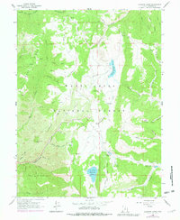
1965 Map of Fairview Lakes
USGS Topo · Published 1979About this map
Skyline Drive follows the high ridgelines of the Manti-La Sal National Forest in this 1965 survey, providing a detailed look at the watershed management and recreational infrastructure of Sanpete County. High-altitude water storage is a central theme, evidenced by Fairview Lakes, Beaver Dam Reservoir, and the Lower Gooseberry Reservoir. These reservoirs are linked by a complex network of drainages including Gooseberry Creek and Cottonwood Creek, which have shaped the high plateaus and canyons.
Find a feature on this map
45 named features on this map. Tap any name to fly to it.
Don’t see what you’re looking for? This feature index may not catch every label — zoom into the map to look around manually.
Map Details
Editions of this 1965 Fairview Lakes Map
2 editions found

Other maps of this area

1885 · Manti
USGS Topo · 1:250,000

1895 · Manti
USGS Topo · 1:250,000

1923 · Scofield
USGS Topo · 1:62,500

1925 · Scofield
USGS Topo · 1:62,500

1939 · Soldier Summit
USGS Topo · 1:62,500

1942 · Soldier Summit
USGS Topo · 1:62,500

1956 · Price
USGS Topo · 1:250,000

1960 · Price
USGS Topo · 1:250,000

1962 · Price
USGS Topo · 1:250,000

1965 · Huntington Reservoir
USGS Topo · 1:24,000