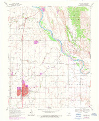
1969 Map of Fairview
USGS Topo · Published 1983About this map
Fairview serves as the focal point of this Major County landscape, where the Atchison Topeka and Santa Fe railroad corridor defines the local transit and development patterns. The town center is densely detailed with its Courthouse, Hospital, and educational facilities like the High School and Chamberlain School. To the north, the small settlement of Orienta sits near the winding course of the Cimarron River, which is flanked by the distinctive geologic formations of Cleo, Stone, and Quinlan.
Find a feature on this map
31 named features on this map. Tap any name to fly to it.
Don’t see what you’re looking for? This feature index may not catch every label — zoom into the map to look around manually.
Map Details
Editions of this 1969 Fairview Map
2 editions found
Other maps of this area

1955 · Woodward
USGS Topo · 1:250,000

1958 · Woodward
USGS Topo · 1:250,000

1969 · Fairview NE
USGS Topo · 1:24,000

1969 · Glass Mountains
USGS Topo · 1:24,000

1969 · Fairview SE
USGS Topo · 1:24,000

1969 · Fairview
USGS Topo · 1:24,000

1969 · Cleo Springs
USGS Topo · 1:24,000

1969 · Glass Mountains NE
USGS Topo · 1:24,000

1972 · Longdale
USGS Topo · 1:24,000

1972 · Homestead
USGS Topo · 1:24,000