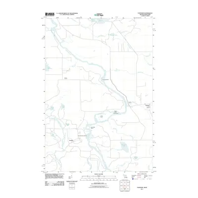
2011 Map of Faithorn
USGS Topo · Published 2011About this map
The Menominee River serves as the central artery for this borderland geography, weaving through a landscape defined by island complexes and riverine landmarks. Significant terrain features such as Nose Peak Island, Ile Le Grand, and Long Island characterize the river's path, while Quiver Falls marks a notable point of hydrological interest along the waterway. The settlement of Faithorn serves as a local hub, anchored by Saint Marys Church and the nearby Riverside Cemetery.
Find a feature on this map
36 named features on this map. Tap any name to fly to it.
Don’t see what you’re looking for? This feature index may not catch every label — zoom into the map to look around manually.
Map Details
Editions of this 2011 Faithorn Map
This is the sole edition of this map. No revisions or reprints were ever made.
Other maps of this area

1939 · Pembine
USGS Topo · 1:48,000

1947 · Pembine
USGS Topo · 1:48,000

1954 · Escanaba
USGS Topo · 1:250,000

1955 · Norway
USGS Topo · 1:24,000

1955 · Vulcan
USGS Topo · 1:24,000

1955 · Norway
USGS Topo · 1:62,500

1956 · Foster City
USGS Topo · 1:62,500

1957 · Escanaba
USGS Topo · 1:250,000

1958 · Escanaba
USGS Topo · 1:250,000

1963 · Pembine
USGS Topo · 1:62,500