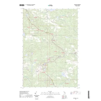
2023 Map of Faithorn
USGS Topo · Published 2023About this map
The Menominee River serves as the primary geographic corridor of this borderland, winding between Michigan and Wisconsin to define the southwestern boundary. Along its course, numerous river islands including Ile Le Grand, Nose Peak Island, Green Island, and Long Island create a complex waterway that supported historic timber and regional transit. The interior landscape is dotted with numerous small lakes such as Lake Shannon, Merryman Lake, and Kimlark Lake, while the Pemebonwon River and its branches feed into the main river channel.
Find a feature on this map
83 named features on this map. Tap any name to fly to it.
Don’t see what you’re looking for? This feature index may not catch every label — zoom into the map to look around manually.
Map Details
Editions of this 2023 Faithorn Map
This is the sole edition of this map. No revisions or reprints were ever made.
Other maps of this area

1939 · Pembine
USGS Topo · 1:48,000

1947 · Pembine
USGS Topo · 1:48,000

1954 · Escanaba
USGS Topo · 1:250,000

1955 · Norway
USGS Topo · 1:24,000

1955 · Vulcan
USGS Topo · 1:24,000

1955 · Norway
USGS Topo · 1:62,500

1956 · Foster City
USGS Topo · 1:62,500

1957 · Escanaba
USGS Topo · 1:250,000

1958 · Escanaba
USGS Topo · 1:250,000

1963 · Pembine
USGS Topo · 1:62,500