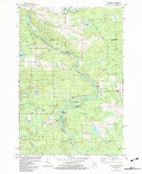
1982 Map of Faithorn
USGS Topo · Published 1983About this map
The Menominee River serves as the winding border between Michigan and Wisconsin, anchoring a landscape shaped by water and early industrial transit in the early 1980s. The settlement of Faithorn stands near the eastern edge, supported by St Marys Ch and proximity to Riverside Cem. This area reveals a significant history of transportation, where the Soo Line tracks intersect with an Old Railroad Grade, tracing the path of former logging or mineral lines.
Find a feature on this map
58 named features on this map. Tap any name to fly to it.
Don’t see what you’re looking for? This feature index may not catch every label — zoom into the map to look around manually.
Map Details
Editions of this 1982 Faithorn Map
This is the sole edition of this map. No revisions or reprints were ever made.
Other maps of this area

1939 · Pembine
USGS Topo · 1:48,000

1947 · Pembine
USGS Topo · 1:48,000

1954 · Escanaba
USGS Topo · 1:250,000

1955 · Norway
USGS Topo · 1:24,000

1955 · Vulcan
USGS Topo · 1:24,000

1955 · Norway
USGS Topo · 1:62,500

1956 · Foster City
USGS Topo · 1:62,500

1957 · Escanaba
USGS Topo · 1:250,000

1958 · Escanaba
USGS Topo · 1:250,000

1963 · Pembine
USGS Topo · 1:62,500