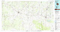
1985 Map of Falfurrias
USGS Topo · Published 1992About this map
The intersection of Hebbronville and Falfurrias anchors this South Texas landscape during the mid-1980s, revealing a region defined by extensive ranchlands and active petroleum extraction. The map details the complex web of oil production across several counties, most notably within the Tijerina Canales Blucher Oil Field and the Premont Oil Field. These industrial sites sit alongside established cattle country settlements like Realitos, Bruni, and Oilton.
Find a feature on this map
44 named features on this map. Tap any name to fly to it.
Don’t see what you’re looking for? This feature index may not catch every label — zoom into the map to look around manually.
Map Details
Editions of this 1985 Falfurrias Map
2 editions found
Other maps of this area

1917 · Ben Bolt
USGS Topo · 1:62,500

1921 · Falfurrias
USGS Topo · 1:125,000

1923 · Armstrong
USGS Topo · 1:62,500

1928 · Sarita
USGS Topo · 1:125,000

1937 · Aguilete Creek
USGS Topo · 1:62,500

1938 · Agua Nueva
USGS Topo · 1:62,500

1938 · Cuevitas
USGS Topo · 1:62,500

1939 · Bruni
USGS Topo · 1:62,500

1939 · Encantada
USGS Topo · 1:62,500

1939 · Randado
USGS Topo · 1:62,500