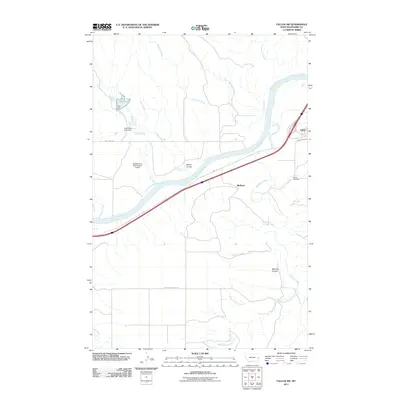
2011 Map of Fallon SW
USGS Topo · Published 2011About this map
The Yellowstone River cuts a wide path through this Prairie County landscape, anchoring a network of drainage systems and agricultural water management features. Near the settlement of Fallon, the terrain is defined by the confluence of major tributaries including O'Fallon Creek, Pine Creek, and Cottonwood Creek. The presence of the Coal Creek Reservoir and multiple structures like the Coal Creek Dam and the Resettlement FSA Number 4 Dam highlight the area's reliance on managed water resources for ranching or irrigation.
Find a feature on this map
25 named features on this map. Tap any name to fly to it.
Don’t see what you’re looking for? This feature index may not catch every label — zoom into the map to look around manually.
Map Details
Editions of this 2011 Fallon SW Map
This is the sole edition of this map. No revisions or reprints were ever made.
Other maps of this area

1953 · Miles City
USGS Topo · 1:250,000

1957 · Miles City
USGS Topo · 1:250,000

1958 · Miles City
USGS Topo · 1:250,000

1966 · Fallon
USGS Topo · 1:24,000
1967 · Fallon NE
USGS Topo · 1:24,000

1969 · Zero NE
USGS Topo · 1:24,000

1969 · Flat Top Butte
USGS Topo · 1:24,000

1969 · Flat Top Butte NE
USGS Topo · 1:24,000

1972 · Hendrickson Coulee
USGS Topo · 1:24,000

1972 · Diamond G Creek
USGS Topo · 1:24,000