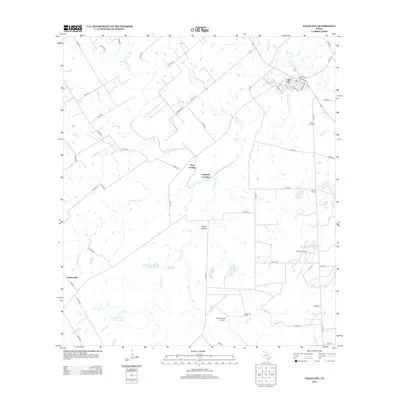
2013 Map of Falls City
USGS Topo · Published 2013About this map
Falls City sits at the northern edge of this Karnes County landscape, where the winding course of the San Antonio River meets local history at Mays Crossing and Conquista Crossing. The area shows a distinct overlap of agricultural roots and industrial development, characterized by the Hobson Oil Field and Hysaw Oil Field. The presence of the Conquista Project Tailings Pond near Conquista Cr indicates the significant mineral extraction history of the region. Local genealogy is anchored by the Falls City Cem and Mueller Cem, while the small settlement of Deweesville and the Burris Ranch Airport provide additional points of interest for those tracing the rural evolution of south-central Texas. Waterways like Las Moras Cr and Marcelinas Cr define the drainage patterns of this terrain, punctuated by the natural feature of Skiles Falls and the man-made Nieschwietz Lake.
Find a feature on this map
56 named features on this map. Tap any name to fly to it.
Don’t see what you’re looking for? This feature index may not catch every label — zoom into the map to look around manually.
Map Details
Editions of this 2013 Falls City Map
This is the sole edition of this map. No revisions or reprints were ever made.
Other maps of this area

1920 · Smiley
USGS Topo · 1:125,000

1925 · Tordia No. 1
USGS Topo · 1:48,000

1931 · Falls City
USGS Topo · 1:62,500

1936 · Floresville
USGS Topo · 1:62,500

1953 · Crystal City
USGS Topo · 1:250,000

1953 · Beeville
USGS Topo · 1:250,000

1953 · Seguin
USGS Topo · 1:250,000

1954 · San Antonio
USGS Topo · 1:250,000

1955 · Crystal City
USGS Topo · 1:250,000

1956 · Beeville
USGS Topo · 1:250,000