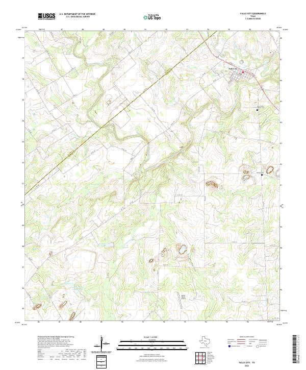
2022 Map of Falls City
USGS Topo · Published 2022About this map
Falls City sits at the northern edge of this south Texas landscape, where the San Antonio River carves a winding path through the brush country. The town's grid is oriented along N Front St and the railroad corridor, serving as a hub for the surrounding ranchlands. The map reveals a complex drainage network including Marcelinas Cr, Les Moras Cr, and the appropriately named Scared Dog Cr, which flow toward the river's main channel.
Find a feature on this map
53 named features on this map. Tap any name to fly to it.
Don’t see what you’re looking for? This feature index may not catch every label — zoom into the map to look around manually.
Map Details
Editions of this 2022 Falls City Map
This is the sole edition of this map. No revisions or reprints were ever made.
Other maps of this area

1920 · Smiley
USGS Topo · 1:125,000

1925 · Tordia No. 1
USGS Topo · 1:48,000

1931 · Falls City
USGS Topo · 1:62,500

1936 · Floresville
USGS Topo · 1:62,500

1953 · Crystal City
USGS Topo · 1:250,000

1953 · Beeville
USGS Topo · 1:250,000

1953 · Seguin
USGS Topo · 1:250,000

1954 · San Antonio
USGS Topo · 1:250,000

1955 · Crystal City
USGS Topo · 1:250,000

1956 · Beeville
USGS Topo · 1:250,000