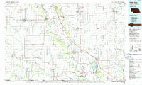
1986 Map of Falls City
USGS Topo · Published 1986About this map
The Missouri River serves as the central artery of this 1980s landscape, carving a winding boundary between the fertile plains of Nebraska and Missouri. This riverine environment is defined by its transition from the agricultural uplands to the bottomlands, where major conservation efforts like the Squaw Creek National Wildlife Refuge and Indian Cave State Park preserve significant reaches of the corridor. The region’s educational and social fabric is anchored by institutions such as Peru State College and Tarkio College, while small towns like Falls City and Mound City function as the primary hubs for the surrounding farmsteads.
Find a feature on this map
140 named features on this map. Tap any name to fly to it.
Don’t see what you’re looking for? This feature index may not catch every label — zoom into the map to look around manually.
Map Details
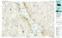
Editions of this 1986 Falls City Map
2 editions found
Other maps of this area

1885 · Atchison
USGS Topo · 1:125,000

1888 · Atchison
USGS Topo · 1:125,000

1888 · Hiawatha
USGS Topo · 1:125,000

1889 · Seneca
USGS Topo · 1:125,000

1893 · Atchison
USGS Topo · 1:125,000

1894 · Seneca
USGS Topo · 1:125,000

1894 · Hiawatha
USGS Topo · 1:125,000

1903 · Weeping Water
USGS Topo · 1:125,000

1907 · Nebraska City
USGS Topo · 1:62,500

1915 · Falls City
USGS Topo · 1:62,500